First Shots: Geomapping Social Media Uploads
By Chuck Sudo in News on Jul 12, 2011 1:00PM
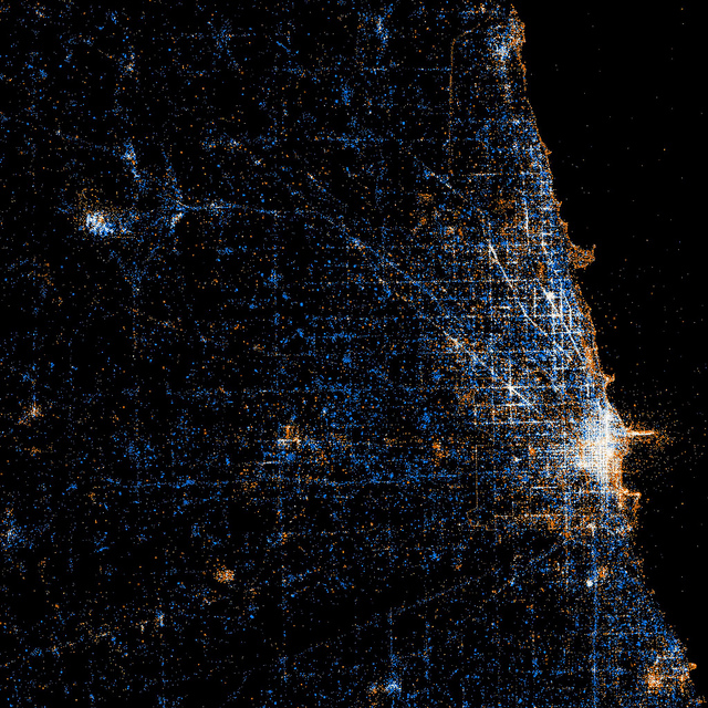
Eric Fischer is something of a map geek. So much so that he's started a series of photos where he maps out the usage of social media in various cities around the globe.
Fischer has taken satellite photos and, using geotagging, mapped out when someone tweets in a metropolitan area (in blue), when someone uploads a photo to Flickr (in red), or when someone does both (in white). This tells us some of you need to put away your phones. (h/t Animal NYC)